Harris County Has 12,793 Wells of Record; 5,618 Are Plugged, Strata9 Data Show
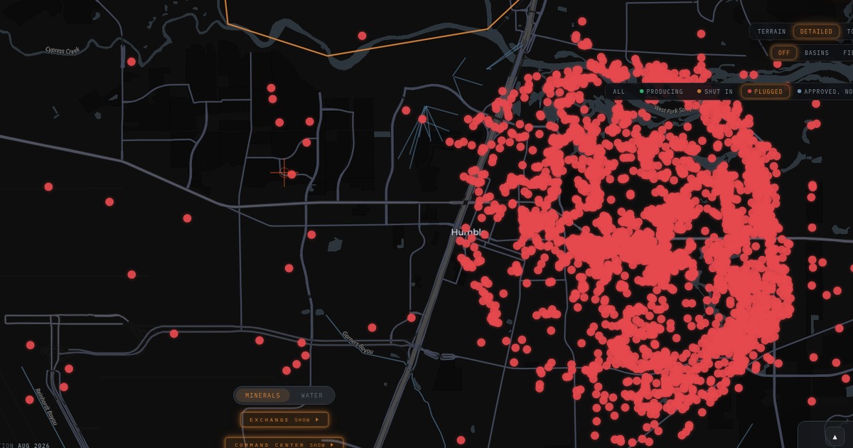
Strata9 maps 12,793 Harris County wells of record by status, from 5,618 plugged to 2,069 listed active with no production on file, so owners can check what sits near them.
Harris County carries 12,793 oil and gas wells of record, and 5,618 of them, or 43.9%, are listed as plugged, according to state filings compiled by Strata9. The rest sit in a mix of statuses that matter to anyone buying land, building, or drilling in the Houston area.
For homeowners, developers, lenders, and operators, the question is not only whether a well was drilled, but what became of it. A well listed as plugged has a recorded end. A well with no recorded plug, no production, and no recent activity is the kind that deserves a closer look before a closing or a permit.
What the status mix shows
Beyond the plugged wells, Strata9 data list 3,253 Harris County wells as dry holes, 822 as producing, 649 as permitted, 352 as cancelled, and 30 as shut in. Another 2,069 carry an active status with no production on file, a category Strata9 shows separately so it is not confused with wells that report volumes.
That 2,069 figure is the one to watch. These wells carry an active status but have no production on file. Strata9 does not label these wells orphaned; that designation belongs to the state.
How Strata9 helps
The Strata9 Oil and Gas map plots every Harris County well of record and lets users filter by status, including Producing, Shut In, and Plugged. Each well card shows its status, well type, operator, lease, and, where the state records one, a plug date, along with lease production history.
That turns a county wide problem into a parcel level check. A buyer near Humble, Baytown, or the Ship Channel can open the map, zoom to a street, and see which wells nearby are plugged and which are not, using state filings compiled by Strata9.
Strata9 data also show 783 operators and 1,865 leases tied to Harris County wells, so users can trace a well back to the company of record. New drilling remains limited: two Harris County drilling permits were issued in the past 365 days, according to Strata9 data.
The county file also records 754 laterals, horizontal legs drilled from existing wellbores, which Strata9 maps alongside the vertical holes so users see the full footprint underground rather than surface locations alone.
On the go
The same map runs on phones through the Strata9 Android app on Google Play, so field crews, landmen, and property owners can check well status on site. Search Harris County directly at strata9.exchange/app.
What to watch next is whether wells listed as active with no production on file are later reported as producing or plugged, a change Strata9 will show as new filings post.